Pride in Precision: Montréal’s Real-Time GNSS Network and Its Legacy
Montréal’s Real-Time GNSS Network (RTN) represents a major step forward in Canada’s geodetic modernization. Built over nearly two decades, the system delivers centimeter-level accuracy across the Montréal region, supporting surveyors, technicians, and emerging smart-city applications.
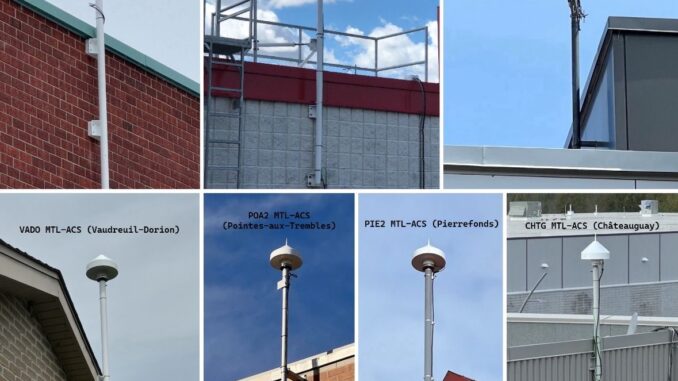
This milestone is the result of years of persistence led by Youssef Smadi, Senior Geodetic Engineer for the city. The initiative required aligning municipal infrastructure with national standards, selecting low-noise antennas, designing long-term stable mounts, and collaborating closely with Natural Resources Canada and partner municipalities.
Today, the network consists of eight strategically distributed stations connected through GNSMART modeling software, currently unique in Canada. Field teams now obtain instant, high-precision positions through a Virtual Reference Station solution, transforming workflows ranging from drone operations to infrastructure monitoring.
Beyond its technical impact, Montréal’s RTN symbolizes a shift in how cities approach geodesy: not only as an essential backbone for public works, but as a strategic investment in resilience, mobility, and the city’s digital future. The network is also fully integrated into national and global geodetic frameworks, positioning Montréal for upcoming transitions such as NATRF2022 and CGVD2013.